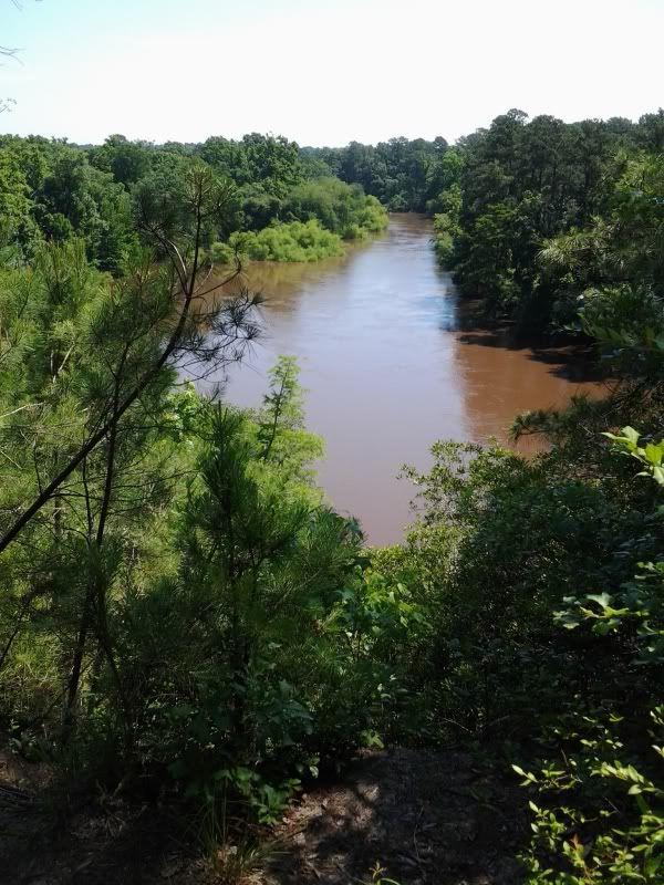
 So this is mostly a lowland flatwater river, right? Sure. Except right here, at the cliffs. On the south bank (where I'm standing to take this picture) the land is a big chunk of limestone 80 or so feet high uplifted during the last Ice Age. The river's trundling along through coastal sediment for hundreds of miles and then whangs into this limestone bluff--which, it should be said, has no business being in the middle of the coastal plain--and you get these nice 90-foot cliffs.
Now if you notice this is not some tidy little blackwater river here. In fact if you look closely you'll see those willows on the left bank of the river (the bright green patch in the middle)... are all the way in the river.
See we just had this thing called Tropical Storm Andrea. It was a few days ago up in the Triangle and for the most part although the lakes are all at full pool there's not water standing everywhere. But a few days' river flow means the Neuse is probably at maximum flood stage here at the Cliffs right now. I didn't really think about that.
So this is mostly a lowland flatwater river, right? Sure. Except right here, at the cliffs. On the south bank (where I'm standing to take this picture) the land is a big chunk of limestone 80 or so feet high uplifted during the last Ice Age. The river's trundling along through coastal sediment for hundreds of miles and then whangs into this limestone bluff--which, it should be said, has no business being in the middle of the coastal plain--and you get these nice 90-foot cliffs.
Now if you notice this is not some tidy little blackwater river here. In fact if you look closely you'll see those willows on the left bank of the river (the bright green patch in the middle)... are all the way in the river.
See we just had this thing called Tropical Storm Andrea. It was a few days ago up in the Triangle and for the most part although the lakes are all at full pool there's not water standing everywhere. But a few days' river flow means the Neuse is probably at maximum flood stage here at the Cliffs right now. I didn't really think about that.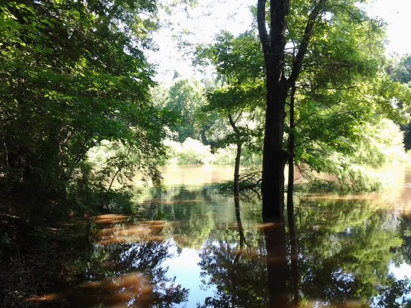 This is the fishing area near the parking lot. Well, actually, the fishing area is under there somewhere. I'm not really sure where. But check it out: in the back, the tree closest to the river? Baldcypress. Haven't seen any up in the Triangle, which surprises me. But that will change once I get mine back from SC and put it in the ground.
Anyway. I came here for the hiking. Here's a picture of the bridge going to two of the three trails:
This is the fishing area near the parking lot. Well, actually, the fishing area is under there somewhere. I'm not really sure where. But check it out: in the back, the tree closest to the river? Baldcypress. Haven't seen any up in the Triangle, which surprises me. But that will change once I get mine back from SC and put it in the ground.
Anyway. I came here for the hiking. Here's a picture of the bridge going to two of the three trails: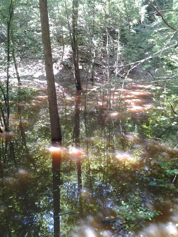 Bear with me, this is a phonecam picture and I own the cheapest phone with the crappiest camera available on the market (actually, it's not even on the market anymore). A third of the way down at the center of that pic you see a little yellowish square? And a bit to the right of it, you can make out the right edge of a brown sign with white letters (click on the picture to blow it up). Those letters indicate the names of the trails. That's the trailhead, over there underwater somewhere. I'm standing at the edge of the water on some steps. There is, in fact, a bridge down there. Really. A whole bridge, all the way under the water.
There was a lot of water in this park. For example, here's another fishing area.
Bear with me, this is a phonecam picture and I own the cheapest phone with the crappiest camera available on the market (actually, it's not even on the market anymore). A third of the way down at the center of that pic you see a little yellowish square? And a bit to the right of it, you can make out the right edge of a brown sign with white letters (click on the picture to blow it up). Those letters indicate the names of the trails. That's the trailhead, over there underwater somewhere. I'm standing at the edge of the water on some steps. There is, in fact, a bridge down there. Really. A whole bridge, all the way under the water.
There was a lot of water in this park. For example, here's another fishing area. 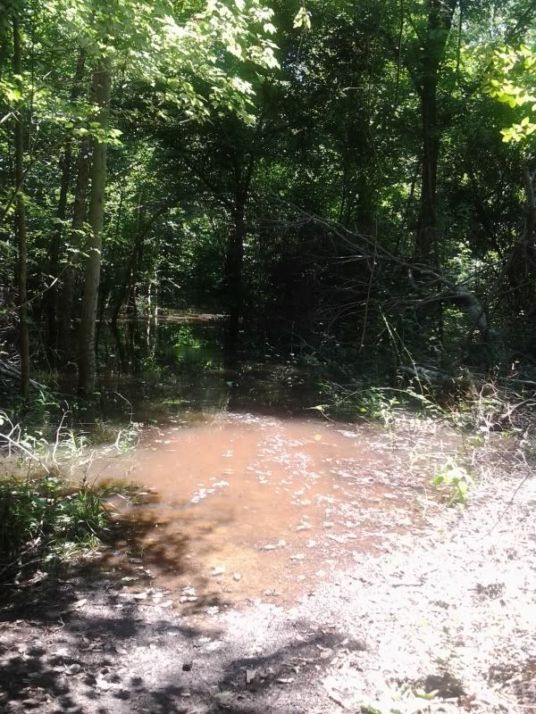 Actually, the fishing area is about 100 yards away through there. But the main trail was accessible, and by going off trail for a bit and getting lost in the woods (well, not lost, but let's say I had no idea where I was. I wasn't lost, though, because I didn't care where I was) I managed to get about two miles of hiking done. There are a lot of steps on the established trails in this park.
There are also a lot of American Beautyberry bushes (Callicarpa americana) in the park.
Actually, the fishing area is about 100 yards away through there. But the main trail was accessible, and by going off trail for a bit and getting lost in the woods (well, not lost, but let's say I had no idea where I was. I wasn't lost, though, because I didn't care where I was) I managed to get about two miles of hiking done. There are a lot of steps on the established trails in this park.
There are also a lot of American Beautyberry bushes (Callicarpa americana) in the park. 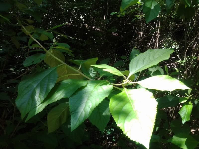 I mean, a whole lot of them. The way Mapleleaf Viburnums were absurdly common in Hemlock Bluffs is how common beautyberries are here. They're nice plants. People plant the Chinese and Japanese versions all the damn time in this country but we have a perfectly good native version with just as many flowers and just as pretty little berries (well, not in June). Some of these bushes were five and six feet tall.
However, it was hard to stop and take pictures. Maybe it's because the water level was so high, but the park and trails were swarming with ants. Not fire ants thank goodness, but I quite literally could not stop for 5 seconds to take a picture of anything without my shoes, socks, and ankles being covered with ants. All parts of all trails were like this. I don't normally mind ants because I don't usually see them in swarms, much less swarms on me, but this was pretty unpleasant.
Alas, with the water level as high as it was it was not possible to see the actual cliff face at Cliffs of Neuse. I'm not actually sure it's ever possible to do so, except from a kayak in the river. So sometime I shall have to put a kayak in this river.
Anyway. Cliffs of Neuse is a nice park; it has lots of campsites, a swimming lake (with paddleboats), and some short trails. You just might want to wait a little longer after a major storm blows through before making a visit.
I mean, a whole lot of them. The way Mapleleaf Viburnums were absurdly common in Hemlock Bluffs is how common beautyberries are here. They're nice plants. People plant the Chinese and Japanese versions all the damn time in this country but we have a perfectly good native version with just as many flowers and just as pretty little berries (well, not in June). Some of these bushes were five and six feet tall.
However, it was hard to stop and take pictures. Maybe it's because the water level was so high, but the park and trails were swarming with ants. Not fire ants thank goodness, but I quite literally could not stop for 5 seconds to take a picture of anything without my shoes, socks, and ankles being covered with ants. All parts of all trails were like this. I don't normally mind ants because I don't usually see them in swarms, much less swarms on me, but this was pretty unpleasant.
Alas, with the water level as high as it was it was not possible to see the actual cliff face at Cliffs of Neuse. I'm not actually sure it's ever possible to do so, except from a kayak in the river. So sometime I shall have to put a kayak in this river.
Anyway. Cliffs of Neuse is a nice park; it has lots of campsites, a swimming lake (with paddleboats), and some short trails. You just might want to wait a little longer after a major storm blows through before making a visit.
On my way home, I stopped by Hinnant Family Vineyards in Pine Level. I like pretty much every winery I've ever been to (even the ones without any actual wines I liked), so henceforth just assume that if I mention a winery here, I'm encouraging you to visit. Hinnant has mostly muscadine and fruit wines, which aren't always my thing, but they make good use of the Blanc du Bois grape and the Norton is very good (there's a bottle of it in my wine fridge right now). And the blackberry wine would be out of this world with a slice of cheesecake. $5 gets you 8 tastings (your choice out of a list of about 20) and a glass.
1 comment:
Was there recently-- ants are worse.
Post a Comment