07 July 2013
Stuff
22 June 2013
Fishing
Then there's the sort of thing that happened to me today. I went out to Lake Wheeler Park and rented a kayak. It was a sit-on-top kayak, which I always find incredibly uncomfortable (I miss my old kayak, which was very comfy but also 16 feet long and a bit of a nightmare to take places), so I spent much of my paddling tour sitting lotus-style on the back end of the boat. This is very peaceful and calming but not conducive to getting anywhere very quickly.
I paddled down one arm of the lake to find the end. It was very quiet; there was a little drizzle, and consequently very few people on the water. I drifted along the shore, past what looked like an anhinga (couldn't have been though, right? This far north?) resting on a branch sticking out of the water, and down a small stream lined with alders. It was peaceful. I drifted by a turtle sitting on a log and the turtle didn't even feel the need to dive into the water.
The alder-lined stream got too narrow, so I went back out by the anhinga-lookalike and down the next channel. This was all rushes and cattails and willows, completely different from the almost exclusively alder community down the stream literally forty or so feet to the south. I pulled the paddle out of the water and laid back in the kayak and just drifted.
And a fish jumped in the boat.
Actually this was entirely terrifying. You don't expect a fish to jump in your boat, especially when you haven't seen any fish all day anyway. And it was so quiet and peaceful, light rain, almost no sound at all, and then *splash* there's a fish flopping around by your feet.
It wasn't a mullet, either (that would have been truly shocking in a small lake in inland North Carolina). I don't know what it was; I would guess some sort of lake bream or something, but it was pretty big, 14-18 inches. I've honestly never seen a bass in my recent life except in that Dan Aykroyd SNL commercial (and that may not have been a bass) so I wouldn't recognize one. This fish was not tall like a bluegill or crappie, though, so that's what it may have been.
I did not fall out of the boat but if I'd been sitting up lotus style on the back of it I definitely would have. As it was I struggled to get up and tried to grab the poor thing, but he kept slipping out of my hands. After probably two seconds (it seemed longer) the fish flopped out of my hands and out of the boat and back into the water. I watched him go; he stirred up the dirt on the bottom, and then jumped again a few feet away from the boat. Maybe he had a parasite he was trying to dislodge.
In any event, given the ease with which fish simply present themselves to me, it seems unsporting to actually go fishing.
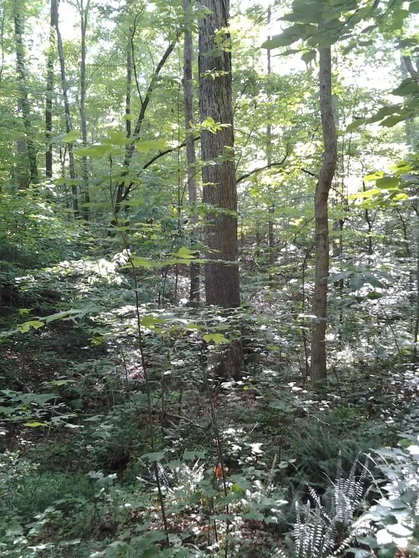
Oh, hey, there aren't any trails at Lake Wheeler Park that I know of, apart from a par course. There's the lake. That's enough reason to go, right? Kayak rental is $5 an hour (they also have canoes and other sorts of floating things). You can park way closer to the rental building than I did; when you go for the first time, just keep driving toward the water and you'll see the final parking lot on the right when the only alternative is to drive into the lake.
19 June 2013
Swift Creek Nature Preserve (and Crowder Park)
 The first thing you see starting on the trail out of the parking lot is this seriously messed up pine tree. I have no idea what caused that; the scars go most of the way up the trunk. This is maybe 20 feet from your car. By this point if you haven't already found and started using a spider stick you need to do so. Seriously. Remember how I said you'd be the only one there? Yeah, possibly the only one in several days. You want a spider stick.
 Another 20 feet along the trail and you come to the first junction... and just down the junction you see this. The rest of this tree is scattered around the grounds. Several others are downed across the trail. The trail is actually closed here and you really should not cross the "closed" sign.
 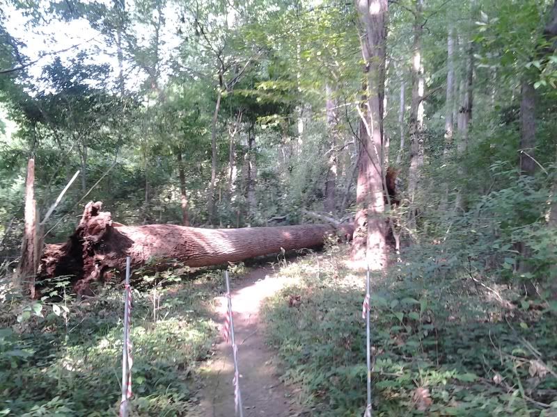 Really. Don't do it.
Okay, fine, so you're going to go where you shouldn't, huh? You just have to follow every single trail in the park? Who does that? I mean, apart from me. First, let me suggest to you that Swift Creek Bluffs won't be in such disarray for all that long; I'm sure they have a work day planned, and I've emailed Triangle Land to ask when that might be so I can go help out. Believe me, the lower part of the trail (through the "Chestnut Oak Swamp") is really in bad shape. It's possible that Tropical Storm Andrea did this much damage, but that seems unlikely; the size and number of trees that are downed throughout the preserve
Really. Don't do it.
Okay, fine, so you're going to go where you shouldn't, huh? You just have to follow every single trail in the park? Who does that? I mean, apart from me. First, let me suggest to you that Swift Creek Bluffs won't be in such disarray for all that long; I'm sure they have a work day planned, and I've emailed Triangle Land to ask when that might be so I can go help out. Believe me, the lower part of the trail (through the "Chestnut Oak Swamp") is really in bad shape. It's possible that Tropical Storm Andrea did this much damage, but that seems unlikely; the size and number of trees that are downed throughout the preserve  makes me guess that after Andrea's rain, one of the storms later in the week probably produced a microburst or mini tornado. You've got to go to really get an idea of the amount of damage. And if that's not enough to dissuade you from crossing the Do Not Cross barriers, examine this downed tree. That's a maple tree. But that maple tree had a very healthy poison ivy plant climbing up it, and all those leaves you see are ivy, not maple. You cannot climb over this tree. You cannot walk around it. You cannot avoid it in any way. So when you come across this tree you will get poison ivy oil on you. (Immunity to urushiol is my superpower, so I was okay.)
Along the closed trails I did come across this wonderful hickory.
makes me guess that after Andrea's rain, one of the storms later in the week probably produced a microburst or mini tornado. You've got to go to really get an idea of the amount of damage. And if that's not enough to dissuade you from crossing the Do Not Cross barriers, examine this downed tree. That's a maple tree. But that maple tree had a very healthy poison ivy plant climbing up it, and all those leaves you see are ivy, not maple. You cannot climb over this tree. You cannot walk around it. You cannot avoid it in any way. So when you come across this tree you will get poison ivy oil on you. (Immunity to urushiol is my superpower, so I was okay.)
Along the closed trails I did come across this wonderful hickory.  Hickories are even harder to differentiate than oaks are; they all look the same for like the first 100 years, and they grow so slowly and live so long. And their wood makes such wonderful cabinets. Anyway, this here is a shagbark hickory, and for the first time in my life I have seen why, in person.
The lower part of the trail, which is a nice hike (the parts of it that are not blocked by downed trees), runs alongside Swift Creek.
Hickories are even harder to differentiate than oaks are; they all look the same for like the first 100 years, and they grow so slowly and live so long. And their wood makes such wonderful cabinets. Anyway, this here is a shagbark hickory, and for the first time in my life I have seen why, in person.
The lower part of the trail, which is a nice hike (the parts of it that are not blocked by downed trees), runs alongside Swift Creek. There is a large population of these trees along the creek. I have no idea what these are. I swear they look like magnolias of some kind, but none of them have any sort of flower or seed that I could see. They're vaguely tropical-looking. I like them but they frustrate me.
Whatever these trees are, the most common tree in the entire park is the stately American Beech.
There is a large population of these trees along the creek. I have no idea what these are. I swear they look like magnolias of some kind, but none of them have any sort of flower or seed that I could see. They're vaguely tropical-looking. I like them but they frustrate me.
Whatever these trees are, the most common tree in the entire park is the stately American Beech.  This is very much a beech forest with other trees; there are easily more beeches in the Swift Creek Preserve than any other single tree. But that's not the whole story. The preserve is called Swift Creek Bluffs. So far we've only walked along the creek.
Frequent readers (I know there are none of those, but I have hopes that will change) will note that Swift Creek is the creek that runs through Hemlock Bluffs Nature Preserve also in Cary. Indeed, if you look on a map you'll note Hemlock Bluffs and Swift Creek are practically next to one another. And the key feature of Swift Creek Bluffs is indeed a high bluff, not unlike the bluffs at Hemlock Bluffs. I wondered if perhaps there'd be a hemlock or two hanging out up there.
This is very much a beech forest with other trees; there are easily more beeches in the Swift Creek Preserve than any other single tree. But that's not the whole story. The preserve is called Swift Creek Bluffs. So far we've only walked along the creek.
Frequent readers (I know there are none of those, but I have hopes that will change) will note that Swift Creek is the creek that runs through Hemlock Bluffs Nature Preserve also in Cary. Indeed, if you look on a map you'll note Hemlock Bluffs and Swift Creek are practically next to one another. And the key feature of Swift Creek Bluffs is indeed a high bluff, not unlike the bluffs at Hemlock Bluffs. I wondered if perhaps there'd be a hemlock or two hanging out up there. There's a long stairway up to the top of the bluff, and then the trail wends along the top for a ways. But it isn't a loop. If you want to make it into a loop you have to take a little side trip onto the Birkhaven greenway trail, which takes you down to a golf course before you can re-enter the preserve. But that's cool. I stumbled around on the bluff for a while and then came back down the stairs and went through a swamp again for a bit and went back to the car.
Swift Creek Bluffs has some nice trails and is certainly an asset to the area, but until the park's been cleaned up and the rest of the trails are open you should probably visit another park instead. If and when you do decide to hike Swift Creek Bluffs, if it's summertime, don't forget the bug spray and the spider stick.
I wasn't quite ready to go back to the apartment after hiking Swift Creek Bluffs. So I turned the car south to Ten-Ten Rd. and stopped at Crowder District Park, a Wake County park in Apex. It's a nice little park but not exactly a big place for hiking. You can come here and take a nice walk on paved trails. The boardwalk across the pond is nice. In the evening, the turtles congregate, looking for handouts. It's a little weird, actually; there are dozens of them and they congregate like ducks expecting you to throw them crusts of bread. Like slow, partially submerged ducks.
There's a long stairway up to the top of the bluff, and then the trail wends along the top for a ways. But it isn't a loop. If you want to make it into a loop you have to take a little side trip onto the Birkhaven greenway trail, which takes you down to a golf course before you can re-enter the preserve. But that's cool. I stumbled around on the bluff for a while and then came back down the stairs and went through a swamp again for a bit and went back to the car.
Swift Creek Bluffs has some nice trails and is certainly an asset to the area, but until the park's been cleaned up and the rest of the trails are open you should probably visit another park instead. If and when you do decide to hike Swift Creek Bluffs, if it's summertime, don't forget the bug spray and the spider stick.
I wasn't quite ready to go back to the apartment after hiking Swift Creek Bluffs. So I turned the car south to Ten-Ten Rd. and stopped at Crowder District Park, a Wake County park in Apex. It's a nice little park but not exactly a big place for hiking. You can come here and take a nice walk on paved trails. The boardwalk across the pond is nice. In the evening, the turtles congregate, looking for handouts. It's a little weird, actually; there are dozens of them and they congregate like ducks expecting you to throw them crusts of bread. Like slow, partially submerged ducks.
18 June 2013
Occoneechee Mountain
 The actual summit of Occoneechee is owned by Orange County, not by the state park system, but a trail will take you there. I didn’t visit it, although at the time I thought I had. I started out heading left from the parking lot. This means that for the first part of the hike I paralleled the interstate, and although the forest is pretty and reasonably peaceful the traffic noise is actually pretty loud.
We forget sometimes that our blueberries are but domesticated forms of plants that still grow wild in this area; the understory in this part of the park has at least three species of blueberries and huckleberries (Vaccinium spp.), in some places entirely covering the ground. The smaller huckleberry species in particular are more common farther west, but there were many lowbush blueberries as well.
The actual summit of Occoneechee is owned by Orange County, not by the state park system, but a trail will take you there. I didn’t visit it, although at the time I thought I had. I started out heading left from the parking lot. This means that for the first part of the hike I paralleled the interstate, and although the forest is pretty and reasonably peaceful the traffic noise is actually pretty loud.
We forget sometimes that our blueberries are but domesticated forms of plants that still grow wild in this area; the understory in this part of the park has at least three species of blueberries and huckleberries (Vaccinium spp.), in some places entirely covering the ground. The smaller huckleberry species in particular are more common farther west, but there were many lowbush blueberries as well.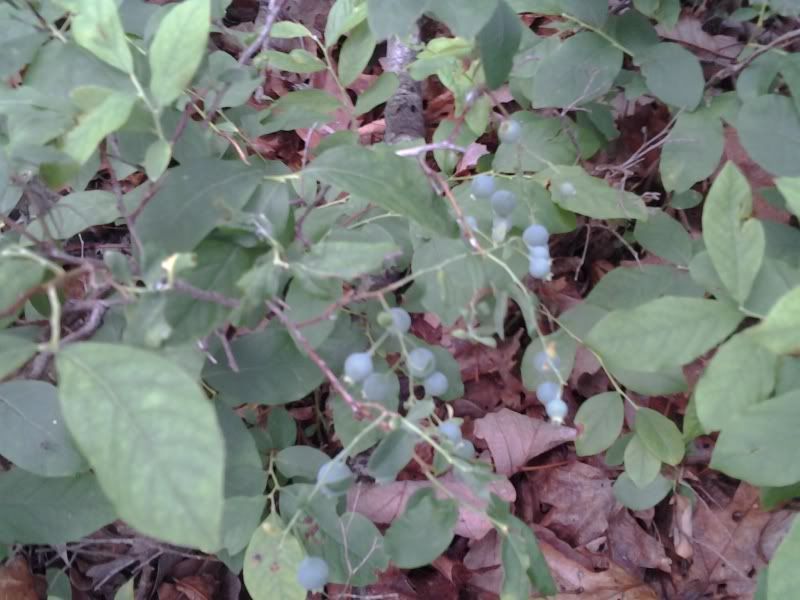 All were still green; some still had flowers. This would be a fun park to walk through in July when the berries are ripe, assuming the birds don’t eat all of them first.
The trail is clear but relatively narrow and has plenty of roots and other trip hazards, and thanks to numerous climbs and descents this would not be a very good park for any but experienced trail runners.
All were still green; some still had flowers. This would be a fun park to walk through in July when the berries are ripe, assuming the birds don’t eat all of them first.
The trail is clear but relatively narrow and has plenty of roots and other trip hazards, and thanks to numerous climbs and descents this would not be a very good park for any but experienced trail runners. 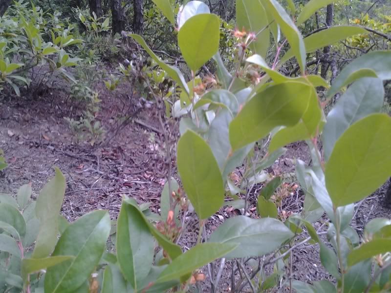 That said, experienced trail runners would enjoy what is probably the most challenging trail in the Triangle.
As the trail turns north away from the interstate the vaccinium species thin out and are replaced by other understory plants including ferns and a large population of witch-hazel. You’ll notice huge chunks of quartz sticking out of the ground every now and then.
That said, experienced trail runners would enjoy what is probably the most challenging trail in the Triangle.
As the trail turns north away from the interstate the vaccinium species thin out and are replaced by other understory plants including ferns and a large population of witch-hazel. You’ll notice huge chunks of quartz sticking out of the ground every now and then. 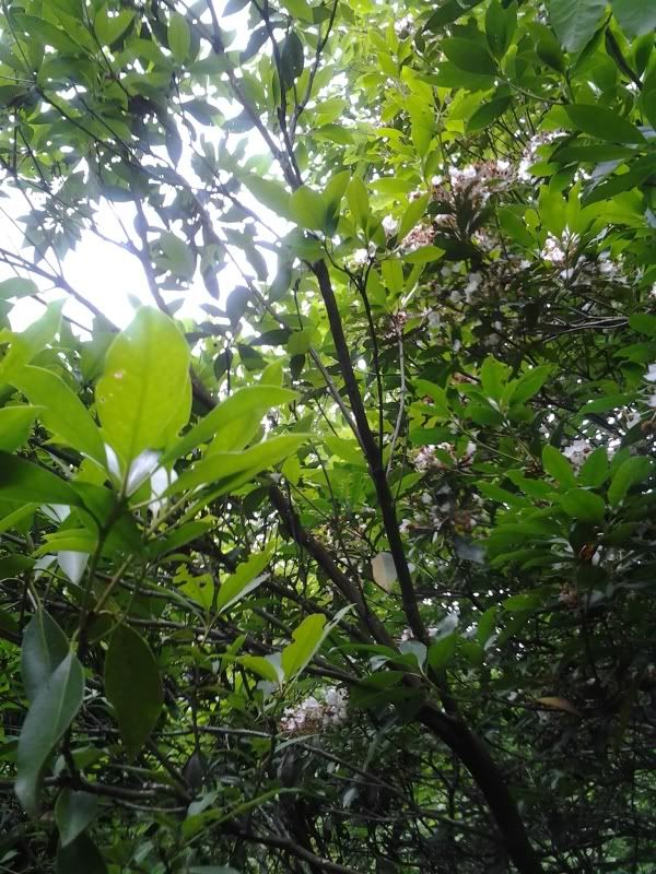 On the north side of the mountain you’ll parallel the Eno River for a ways, and begin to see Mountain Laurel and some native azaleas. There’s a short spur trail to a very nice swimming hole, though it is apparently on private property. (Still, there were several people swimming and I don’t get the impression the private owners are terribly upset about it.) Past this short spur, both sides of the trail host quite the healthy population of poison ivy. Watch for it if you’re susceptible.
When the trail turns away from the river it ascends some stairs and a spur leads off to the “Occoneechee Quarry.” I took the spur. The quarry turns out to be a huge face of quartz that’s been just torn to bits; unmolested quartz rocks like this are found throughout the piedmont with names like “Shining Rock” or “Looking Glass Mountain” because the smooth face of the rock reflects the sun in early morning when damp with dew. At one time, Occoneechee Mountain looked like that. No more.
You are specifically told not to engage in any rock climbing or rappelling activities on this degraded rock face, which is good advice because the rock is just broken all to hell and very friable, so put too much weight on any part of it and it would likely just break off and send you tumbling down the mountain into the river (this actually sounds like fun, until you consider that along the way you'd tumble across a bunch of very pointy rocks and through a whole field of poison ivy).
On the north side of the mountain you’ll parallel the Eno River for a ways, and begin to see Mountain Laurel and some native azaleas. There’s a short spur trail to a very nice swimming hole, though it is apparently on private property. (Still, there were several people swimming and I don’t get the impression the private owners are terribly upset about it.) Past this short spur, both sides of the trail host quite the healthy population of poison ivy. Watch for it if you’re susceptible.
When the trail turns away from the river it ascends some stairs and a spur leads off to the “Occoneechee Quarry.” I took the spur. The quarry turns out to be a huge face of quartz that’s been just torn to bits; unmolested quartz rocks like this are found throughout the piedmont with names like “Shining Rock” or “Looking Glass Mountain” because the smooth face of the rock reflects the sun in early morning when damp with dew. At one time, Occoneechee Mountain looked like that. No more.
You are specifically told not to engage in any rock climbing or rappelling activities on this degraded rock face, which is good advice because the rock is just broken all to hell and very friable, so put too much weight on any part of it and it would likely just break off and send you tumbling down the mountain into the river (this actually sounds like fun, until you consider that along the way you'd tumble across a bunch of very pointy rocks and through a whole field of poison ivy).
 That said, there are a number of paths directly up the side of the mountain here that don’t require any actual climbing, so I’ll say what I did was hike very steeply uphill with some help from my hands. At the top, there’s a wooden fence to hold visitors back from the edge. I took this to be the summit but later on reviewing MapMyRun’s gps map of my hike (at the bottom of this post) it looks like this was just one face of the hill, and the actual summit trail and summit was still some ways away to the east of where I climbed. So I’ll have to visit again.
Along the way to the top, I found a huckleberry bush with a few ripe fruits. They were delicious.
A short trail connects what I thought was the summit trail to the eastern edge of the park loop trail, along the top of Brown Elfin Knob. This trail goes through a large population of mountain laurel mixed with rhododendron and another large population of vaccinium bushes, mainly huckleberries this time. It is an easy trail and shorter than I expected. The summit is insignificant; time was when this small hill would have been topped with an observation tower but insurance costs have eliminated most such towers from American public lands. It's less a brown elfin knob than a brown elfin gentle-rise-in-the-landscape.
The last portion of the loop trail runs beside two fish ponds and features more typical lowland species including canebrake and boxelder, which weren't anywhere else in the park including along the river. If you forgot the bug spray back when you got out of the car at the start of the hike, this part is really going to be unpleasant. But it's flat, so you could run. Think of the bugs as zombies. In a way, they are...
This was a very enjoyable hike and particularly interesting for the large variations in forest type given the small area. I hiked 2.7 miles including my short vertical ascent, though there are at least another 2 miles of trails in the park. These trails are probably among the most strenuous in the Triangle (though very easy relative to a typical trail in the mountains). Also they have the most available forage, if for some reason you get lost and need to survive in the wilderness for a while...although you could just follow the sound of traffic and be standing next to I-85 in half an hour or less.
I drove all the way to Hillsborough for this hike and didn't think to stop at a winery or a brewery (Mystery Brewing is there and you should totally stop in because they rock). But I have to go back to do the rest of the trails sometime, so I can make up for this tragic oversight.
That said, there are a number of paths directly up the side of the mountain here that don’t require any actual climbing, so I’ll say what I did was hike very steeply uphill with some help from my hands. At the top, there’s a wooden fence to hold visitors back from the edge. I took this to be the summit but later on reviewing MapMyRun’s gps map of my hike (at the bottom of this post) it looks like this was just one face of the hill, and the actual summit trail and summit was still some ways away to the east of where I climbed. So I’ll have to visit again.
Along the way to the top, I found a huckleberry bush with a few ripe fruits. They were delicious.
A short trail connects what I thought was the summit trail to the eastern edge of the park loop trail, along the top of Brown Elfin Knob. This trail goes through a large population of mountain laurel mixed with rhododendron and another large population of vaccinium bushes, mainly huckleberries this time. It is an easy trail and shorter than I expected. The summit is insignificant; time was when this small hill would have been topped with an observation tower but insurance costs have eliminated most such towers from American public lands. It's less a brown elfin knob than a brown elfin gentle-rise-in-the-landscape.
The last portion of the loop trail runs beside two fish ponds and features more typical lowland species including canebrake and boxelder, which weren't anywhere else in the park including along the river. If you forgot the bug spray back when you got out of the car at the start of the hike, this part is really going to be unpleasant. But it's flat, so you could run. Think of the bugs as zombies. In a way, they are...
This was a very enjoyable hike and particularly interesting for the large variations in forest type given the small area. I hiked 2.7 miles including my short vertical ascent, though there are at least another 2 miles of trails in the park. These trails are probably among the most strenuous in the Triangle (though very easy relative to a typical trail in the mountains). Also they have the most available forage, if for some reason you get lost and need to survive in the wilderness for a while...although you could just follow the sound of traffic and be standing next to I-85 in half an hour or less.
I drove all the way to Hillsborough for this hike and didn't think to stop at a winery or a brewery (Mystery Brewing is there and you should totally stop in because they rock). But I have to go back to do the rest of the trails sometime, so I can make up for this tragic oversight.
13 June 2013
Cliffs of the Neuse
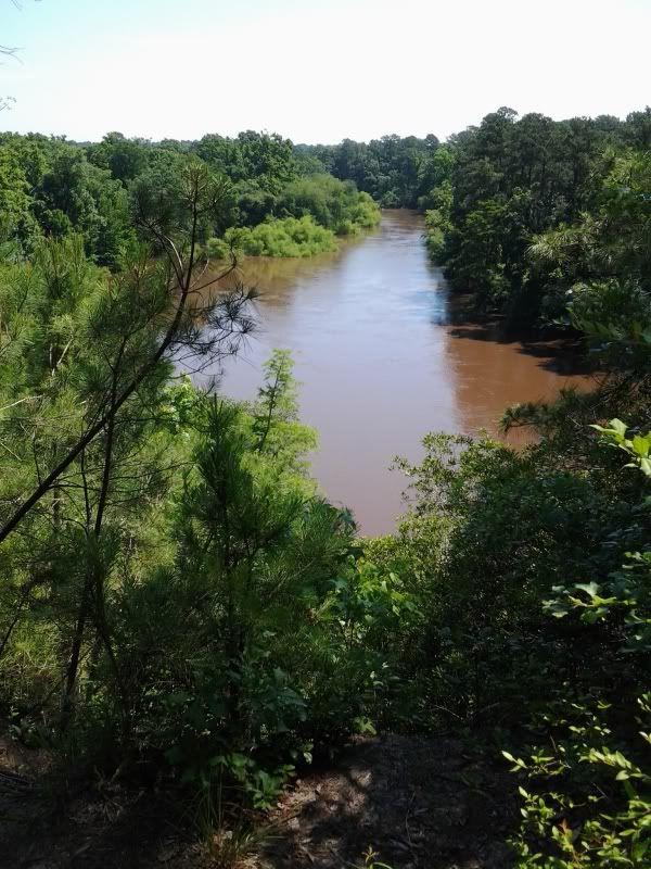 So this is mostly a lowland flatwater river, right? Sure. Except right here, at the cliffs. On the south bank (where I'm standing to take this picture) the land is a big chunk of limestone 80 or so feet high uplifted during the last Ice Age. The river's trundling along through coastal sediment for hundreds of miles and then whangs into this limestone bluff--which, it should be said, has no business being in the middle of the coastal plain--and you get these nice 90-foot cliffs.
Now if you notice this is not some tidy little blackwater river here. In fact if you look closely you'll see those willows on the left bank of the river (the bright green patch in the middle)... are all the way in the river.
See we just had this thing called Tropical Storm Andrea. It was a few days ago up in the Triangle and for the most part although the lakes are all at full pool there's not water standing everywhere. But a few days' river flow means the Neuse is probably at maximum flood stage here at the Cliffs right now. I didn't really think about that.
So this is mostly a lowland flatwater river, right? Sure. Except right here, at the cliffs. On the south bank (where I'm standing to take this picture) the land is a big chunk of limestone 80 or so feet high uplifted during the last Ice Age. The river's trundling along through coastal sediment for hundreds of miles and then whangs into this limestone bluff--which, it should be said, has no business being in the middle of the coastal plain--and you get these nice 90-foot cliffs.
Now if you notice this is not some tidy little blackwater river here. In fact if you look closely you'll see those willows on the left bank of the river (the bright green patch in the middle)... are all the way in the river.
See we just had this thing called Tropical Storm Andrea. It was a few days ago up in the Triangle and for the most part although the lakes are all at full pool there's not water standing everywhere. But a few days' river flow means the Neuse is probably at maximum flood stage here at the Cliffs right now. I didn't really think about that.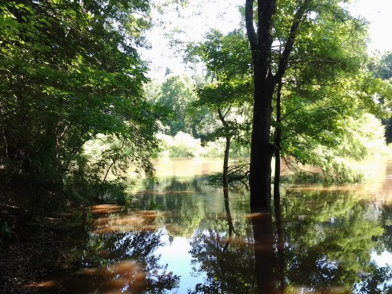 This is the fishing area near the parking lot. Well, actually, the fishing area is under there somewhere. I'm not really sure where. But check it out: in the back, the tree closest to the river? Baldcypress. Haven't seen any up in the Triangle, which surprises me. But that will change once I get mine back from SC and put it in the ground.
Anyway. I came here for the hiking. Here's a picture of the bridge going to two of the three trails:
This is the fishing area near the parking lot. Well, actually, the fishing area is under there somewhere. I'm not really sure where. But check it out: in the back, the tree closest to the river? Baldcypress. Haven't seen any up in the Triangle, which surprises me. But that will change once I get mine back from SC and put it in the ground.
Anyway. I came here for the hiking. Here's a picture of the bridge going to two of the three trails: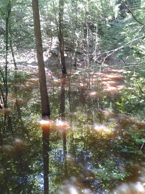 Bear with me, this is a phonecam picture and I own the cheapest phone with the crappiest camera available on the market (actually, it's not even on the market anymore). A third of the way down at the center of that pic you see a little yellowish square? And a bit to the right of it, you can make out the right edge of a brown sign with white letters (click on the picture to blow it up). Those letters indicate the names of the trails. That's the trailhead, over there underwater somewhere. I'm standing at the edge of the water on some steps. There is, in fact, a bridge down there. Really. A whole bridge, all the way under the water.
There was a lot of water in this park. For example, here's another fishing area.
Bear with me, this is a phonecam picture and I own the cheapest phone with the crappiest camera available on the market (actually, it's not even on the market anymore). A third of the way down at the center of that pic you see a little yellowish square? And a bit to the right of it, you can make out the right edge of a brown sign with white letters (click on the picture to blow it up). Those letters indicate the names of the trails. That's the trailhead, over there underwater somewhere. I'm standing at the edge of the water on some steps. There is, in fact, a bridge down there. Really. A whole bridge, all the way under the water.
There was a lot of water in this park. For example, here's another fishing area. 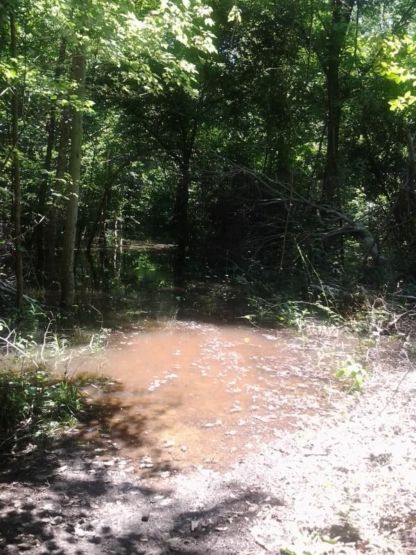 Actually, the fishing area is about 100 yards away through there. But the main trail was accessible, and by going off trail for a bit and getting lost in the woods (well, not lost, but let's say I had no idea where I was. I wasn't lost, though, because I didn't care where I was) I managed to get about two miles of hiking done. There are a lot of steps on the established trails in this park.
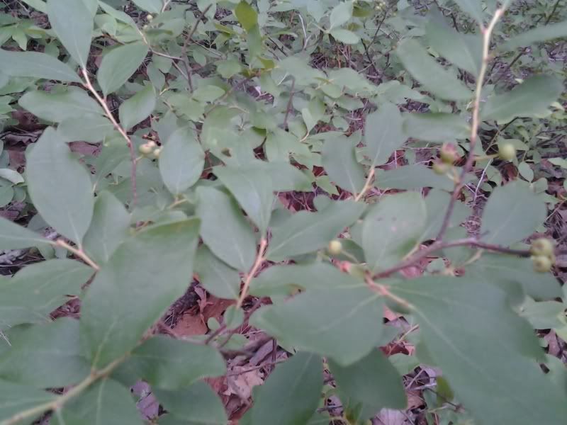
There are also a lot of American Beautyberry bushes (Callicarpa americana) in the park.
Actually, the fishing area is about 100 yards away through there. But the main trail was accessible, and by going off trail for a bit and getting lost in the woods (well, not lost, but let's say I had no idea where I was. I wasn't lost, though, because I didn't care where I was) I managed to get about two miles of hiking done. There are a lot of steps on the established trails in this park.
There are also a lot of American Beautyberry bushes (Callicarpa americana) in the park. 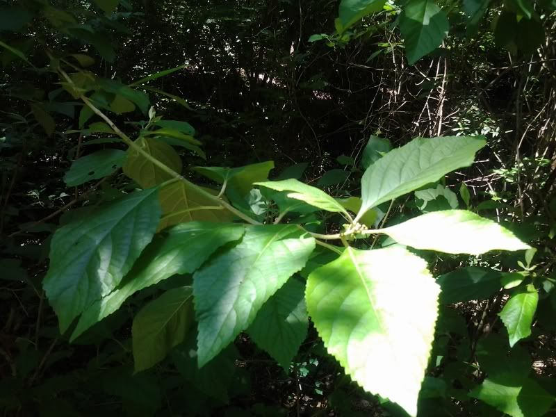 I mean, a whole lot of them. The way Mapleleaf Viburnums were absurdly common in Hemlock Bluffs is how common beautyberries are here. They're nice plants. People plant the Chinese and Japanese versions all the damn time in this country but we have a perfectly good native version with just as many flowers and just as pretty little berries (well, not in June). Some of these bushes were five and six feet tall.
However, it was hard to stop and take pictures. Maybe it's because the water level was so high, but the park and trails were swarming with ants. Not fire ants thank goodness, but I quite literally could not stop for 5 seconds to take a picture of anything without my shoes, socks, and ankles being covered with ants. All parts of all trails were like this. I don't normally mind ants because I don't usually see them in swarms, much less swarms on me, but this was pretty unpleasant.
Alas, with the water level as high as it was it was not possible to see the actual cliff face at Cliffs of Neuse. I'm not actually sure it's ever possible to do so, except from a kayak in the river. So sometime I shall have to put a kayak in this river.
Anyway. Cliffs of Neuse is a nice park; it has lots of campsites, a swimming lake (with paddleboats), and some short trails. You just might want to wait a little longer after a major storm blows through before making a visit.
I mean, a whole lot of them. The way Mapleleaf Viburnums were absurdly common in Hemlock Bluffs is how common beautyberries are here. They're nice plants. People plant the Chinese and Japanese versions all the damn time in this country but we have a perfectly good native version with just as many flowers and just as pretty little berries (well, not in June). Some of these bushes were five and six feet tall.
However, it was hard to stop and take pictures. Maybe it's because the water level was so high, but the park and trails were swarming with ants. Not fire ants thank goodness, but I quite literally could not stop for 5 seconds to take a picture of anything without my shoes, socks, and ankles being covered with ants. All parts of all trails were like this. I don't normally mind ants because I don't usually see them in swarms, much less swarms on me, but this was pretty unpleasant.
Alas, with the water level as high as it was it was not possible to see the actual cliff face at Cliffs of Neuse. I'm not actually sure it's ever possible to do so, except from a kayak in the river. So sometime I shall have to put a kayak in this river.
Anyway. Cliffs of Neuse is a nice park; it has lots of campsites, a swimming lake (with paddleboats), and some short trails. You just might want to wait a little longer after a major storm blows through before making a visit.
On my way home, I stopped by Hinnant Family Vineyards in Pine Level. I like pretty much every winery I've ever been to (even the ones without any actual wines I liked), so henceforth just assume that if I mention a winery here, I'm encouraging you to visit. Hinnant has mostly muscadine and fruit wines, which aren't always my thing, but they make good use of the Blanc du Bois grape and the Norton is very good (there's a bottle of it in my wine fridge right now). And the blackberry wine would be out of this world with a slice of cheesecake. $5 gets you 8 tastings (your choice out of a list of about 20) and a glass.
10 June 2013
Hemlock Bluffs Nature Preserve
 The trail down to the Swift Creek loop is stairs, but the loop itself is flat and also well maintained. This is an excellent park for a trail run, especially for those new to trail-running.
The Chestnut Oak trail covers a fairly typical coastal plain environment, with a forest of primarily chestnut oak, red maple, and beech; look for maple-leaf viburnum, a somewhat rare shrub so predominant in this park it might be the single most common understory plant. This park will be brilliant in early autumn thanks to a big population of maples; a good number of serviceberry and other small trees and shrubs should provide a decent springtime floral display though not spectacular.
The trail down to the Swift Creek loop is stairs, but the loop itself is flat and also well maintained. This is an excellent park for a trail run, especially for those new to trail-running.
The Chestnut Oak trail covers a fairly typical coastal plain environment, with a forest of primarily chestnut oak, red maple, and beech; look for maple-leaf viburnum, a somewhat rare shrub so predominant in this park it might be the single most common understory plant. This park will be brilliant in early autumn thanks to a big population of maples; a good number of serviceberry and other small trees and shrubs should provide a decent springtime floral display though not spectacular.
 Follow the main trail to the right and you’ll come to the Swift Creek ravine. The trail descends the ravine on well-made gravel-topped stairs, and two spurs from the stairs allow you to look at the truly unique aspect of this park, the Eastern Hemlocks on the south wall of the ravine.
This relict population of hemlock is separated from the rest of the species’ distribution by some 150 miles. The trees survive here (some of the trees are old enough to predate European settlement in the Neuse basin) thanks to an unusual microclimate on the steep banks of Swift Creek.
Follow the main trail to the right and you’ll come to the Swift Creek ravine. The trail descends the ravine on well-made gravel-topped stairs, and two spurs from the stairs allow you to look at the truly unique aspect of this park, the Eastern Hemlocks on the south wall of the ravine.
This relict population of hemlock is separated from the rest of the species’ distribution by some 150 miles. The trees survive here (some of the trees are old enough to predate European settlement in the Neuse basin) thanks to an unusual microclimate on the steep banks of Swift Creek.  Because of the disjunct nature of this population they have no woolly adelgid infestation; it’s possible, sadly, that this might be the last healthy population of hemlocks in the eastern U.S. in another 20 years. The hemlocks share the streambank with a large population of galax and several other plants more commonly found in the piedmont and mountains.
The Swift Creek Loop is on lowland in the creek basin, below the ravines. This is a short, level loop through wet bottomlands. Bug spray is mandatory before attempting this trail.
Throughout the park the squirrels are so fat and unmolested they don’t even run away from you when you walk directly toward them. And when they do scamper, it’s with the studied leisure of animals secure in their safety. Let them have their peace; please keep your dog on a short leash.
Because of the disjunct nature of this population they have no woolly adelgid infestation; it’s possible, sadly, that this might be the last healthy population of hemlocks in the eastern U.S. in another 20 years. The hemlocks share the streambank with a large population of galax and several other plants more commonly found in the piedmont and mountains.
The Swift Creek Loop is on lowland in the creek basin, below the ravines. This is a short, level loop through wet bottomlands. Bug spray is mandatory before attempting this trail.
Throughout the park the squirrels are so fat and unmolested they don’t even run away from you when you walk directly toward them. And when they do scamper, it’s with the studied leisure of animals secure in their safety. Let them have their peace; please keep your dog on a short leash. 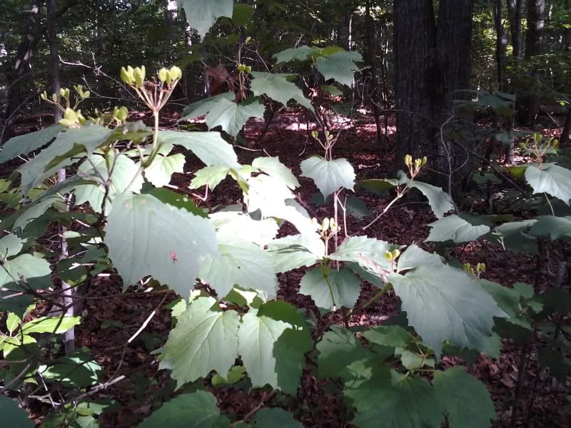 Hemlock Bluffs preserves an interesting microbiome unique in the Triangle area. The park is very quiet and peaceful, and even on a nice Saturday afternoon was not particularly busy. It’s a real find this close to the center of town.
The route with elevations. Note the actual elevation changes are pretty mild, despite the way the chart looks. If you wanted to do say a 5k trail run, you'd probably just want to circle the Chestnut Oak loop 3 times; the stairs down to the Swift Creek Loop (on the right in the map) could be a problem.
Hemlock Bluffs preserves an interesting microbiome unique in the Triangle area. The park is very quiet and peaceful, and even on a nice Saturday afternoon was not particularly busy. It’s a real find this close to the center of town.
The route with elevations. Note the actual elevation changes are pretty mild, despite the way the chart looks. If you wanted to do say a 5k trail run, you'd probably just want to circle the Chestnut Oak loop 3 times; the stairs down to the Swift Creek Loop (on the right in the map) could be a problem.